


A consultative meeting of stakeholders on GIS-based master plan for ‘Greater Dimapur Planning Area’, which envisages a sustainable growth for the city over the next 25 years, was held at Tourist Lodge in Dimapur on Friday.
The meeting was organised by the Urban Development Department (UDD), Nagaland, which had undertaken the preparation of GIS-based master plan for Dimapur and Kohima under the Atal Mission for Rejuvenation and Urban Transformation (AMRUT) scheme, and the assignment was given to M/s. Remote Sensing Instruments (RSI) Hyderabad.
Geographic Information System (GIS) is a computer-based tool for visualising, storing and analysing data related to geography such as streets, buildings, space, vegetation etc.
It was informed that the master plan for Greater Dimapur has been prepared for the perspective year 2041.
Speaking at the meeting, Director of UDD, Chenithung Lotha, informed that the master plan is a perspective plan, which will take care of the city planning right from regional to micro level. Different aspects of planning, including transportation, housing and how the city should grow, have been considered, he added.
While informing that the consultants took about four years to come up with the master plan, the official said a meeting with the stakeholders was necessary before the plan is published.
Senior manager of RSI, Hyderabad, Raman Rao stated that in the present stage, the master plan is only a vision document on how to properly plan the land uses for the next 25 years.
The implementation part will come in the later years when the master plan is approved and finalised, he said, adding that all their proposals will be included in the master plan policy.
However, it depends on the state government whether or not to act upon the master plan, Rao added.
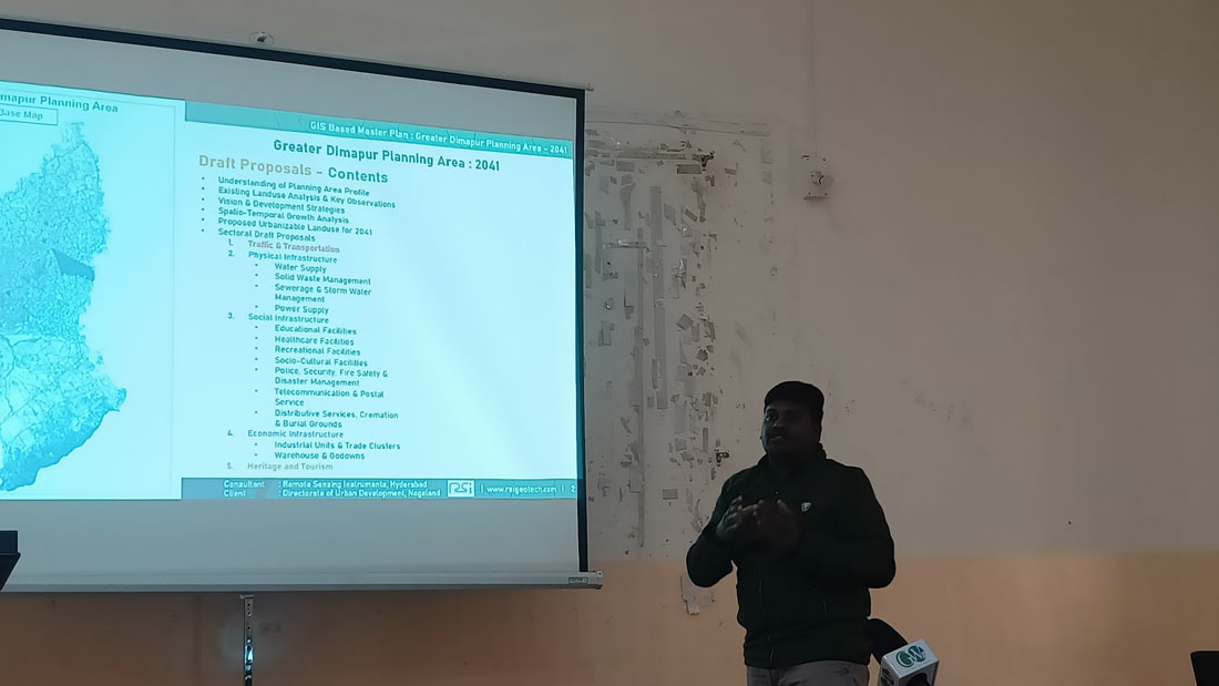
The content of the draft proposal include understanding of planning area profile, existing landuse analysis and key observations, vision and development strategies, spatio-temporal growth analysis and proposed urbanisable landuse for 2041.
The proposal under sectoral draft, as mentioned in the presentation, include traffic and transportation; physical, social and economic infrastructure; and heritage and tourism.
It was informed that two cities from Nagaland, namely, Greater Dimapur and Kohima Capital Region, have been selected for urban planning under the AMRUT scheme.
For Greater Dimapur, the planning area covers 143.74 sq km, including three Urban Local Bodies (ULBs) and 45 villages with proposed population of 4,94,699 from the existing 2,30,029 population.
For Kohima Capital Region, the planning area covers 96.80 sq km, which include one ULB and six villages with proposed population of 3,25,922 from the existing 1,28,109.
For Kohima Capital Region, the planning area covers 96.80 sq km, which include one ULB and six villages with proposed population of 3,25,922 from the existing 1,28,109.
For Kohima Capital Region, the planning area covers 96.80 sq km, which include one ULB and six villages with proposed population of 3,25,922 from the existing 1,28,109.
For Kohima Capital Region, the planning area covers 96.80 sq km, which include one ULB and six villages with proposed population of 3,25,922 from the existing 1,28,109. sdfhgg dghj
For Kohima Capital Region, the planning area covers 96.80 sq km, which include one ULB and six villages with proposed population of 3,25,922 from the existing 1,28,109.
For Kohima Capital Region, the planning area covers 96.80 sq km, which include one ULB and six villages with proposed population of 3,25,922 from the existing 1,28,109. dfbh GIS GIS