
Nagaland
Training on GIS-based gram panchayat planning underway

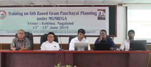
Dimapur, June 12 (EMN): A four-day training on GIS-based Gram Panchayat Planning under MGNREGA got underway at the conference hall of Rural Development (RD) on June 12. The training is sponsored by the Ministry of Rural Development, GOI, and Government of Nagaland with resources persons from MoRD and ICRG.
Delivering the opening remark at the inaugural session, RD Secretary Neposo Theluo remarked that one of the core objectives of MGNREGA is to strengthen the rural livelihood resources through creation of productive assets in addition to generating unskilled employment. To achieve this objective, he said the ministry is strengthening planning of Natural Resource Management (NRM) works under MGNREGA using advanced technologies.
He opined that those technologies would help in decision making and also enhance the impacts of NRM works taken up and also provide scientific inputs to support the community-based participatory planning process at the grassroot level.
“The planning of works using geospatial technologies is an important initiative that will help the State government to do geospatial planning and monitoring appropriately,” he stated. He also informed that as per the directive of the Ministry, the department has selected two villages from each block to take up GIS-based planning on a pilot basis for the current financial year.
The Secretary however lamented that so far no proper training has been imparted to the officers on the programme which has caused the State to lag behind in that aspect. He expressed gratitude to the MoRD for sending the expert resource persons all the way from Delhi and Chattisgarh to impart first-hand training to the officers. He further called upon the trainees to be sincere and attentive and to take full advantage of the opportunity to learn about GIS-based planning.
The four-day training would cover topics on GIS-based planning, tools and apps for planning, data collection/ processing, understanding water budget, map analysis and hands on working on Bhuvan Portal/ Google Earth. The resource persons from MoRD and ICRG included Avanindra Kumar, Raj Kumar Prasas, Ashish Nanda and Alok Oraon.
The inaugural session was chaired by RD Director, Imlimeren Jamir, while the vote of thanks was delivered by MGNREGA Programme Officer and Joint Director, Asangla T Aier.